Entry Points:

About McKinley County

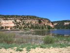
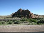
McKinley County covers 5,455 square miles on the western border of New Mexico. The elevation is high and mountains cover much of the county, especially in the southern areas and along the western border. The mountains are forested and beautiful. In the southeast corner is Mount Taylor which reaches to 11,301 feet in elevation. Flat desert land lies along the northern border.

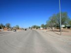
Gallup is the county seat of McKinley County, and the population is 74,798 (2000 census). Interstate 40 is the major highway through the county, passing east to west near the southern border, passing through Gallup. U.S. Highway 491 (formerly 666) heads north from Gallup and State Highway 602 heads south from there.

74 percent of the population is Native American. The Zuni Indian Reservation covers the southwest corner of the county, and the Navajo Indian Reservation includes the northwest corner.


Street Index


a dirt road
a road
Army Depot Road
Barnett Lane
Bean Farm Road
Blackhawk Road
Bluejay Road
Bossom Wash Drive
Bread Springs Road
Broken Arrow Road
Bronco Road
Canyon Well Road
Catalpa Canyon Road
Dee Ann Avenue
Dusty Road
Eagle Lane
El Paso Circle
F.S. Route 157
Hasler Valley Road
Historic Route 66
Interstate 40
Itanbito Road
Jack Woods Road
Jones Ranch Road
Lambson Street
Niya Drive
North Sitting Rocks Road
Nutria Lake Road
Oak Street
Pine Haven Road
Pine Tree Wash Road
Pueblo Road
Raven Road
Red Rock Chapter House Road
Rodeo Road
Route 113
Route 3037
Sagar Drive
Skeets Road
State Highway 36
State Highway 400
State Highway 53
State Highway 566
State Highway 602
Sundance Road
Superman Canyon Road
Uprooted Tree Road
Wooded Hill Road
Zuni Route 301
Zuni Route 4

In McKinley County:

2,118 Photographs

McKinley County is in:

Services:

Cities:


TERMS + CONDITIONS | COPYRIGHT 1999-2016 UNTRAVELEDROAD